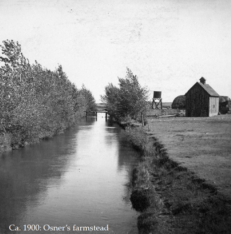
In 1859, a gold rush prompted the settling of the Cherry Creek and South Platte River regions. A private company launched a commercial venture in 1881 to bring water to settlers near their confluence.
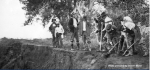
Dug by hand, the 71-mile High Line Canal was completed in 1883. High line canals are named for the high-line engineering principle, whereby the canal follows the natural land contours at the highest elevation possible with minimal elevation drops along its course. This promotes gravity-driven flow and results in multiple twists and turns to maintain elevation.
Denver Water acquired the resource as a public utility in 1924. Over the succeeding years however, the canal outlived its historic purpose. As an unlined conduit, Denver Water estimates the canal loses 60-80% of its precious water to evaporation and seepage.
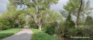
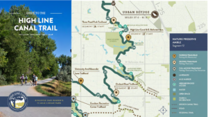
In 1970, the High Line Canal opened to recreation and today it is designated a National Landmark Trail. Now closed to unauthorized motor vehicles, approximately 60 miles of the canal trail have been improved for use and are open year round to hikers, bikers, joggers, and – in some segments – equestrians. At 860 acres, this natural linear greenway is larger than New York City’s Central Park! Much of the High Line Canal Trail is shaded by mature cottonwood trees, making it an ideal habitat for the more than 190 bird, 25+ mammal and 15+ reptile species that have been recorded there. Over 350,000 residents live within one mile of the trail. The High Line Canal features five distinct character zones from its southern beginnings to its northern terminus: wild canyon, rolling foothills, wooded village, urban refuge and prairie retreat.
“There’s really nothing quite like the High Line Canal in its scale and ambition and for its ultimate impact on this community,” states Gina Ford, Principal, Agency Landscape & Planning, speaking of the future development of the recreational resource. “It will be a model for other communities around the country and around the world about how to think about infrastructure to really make impactful change in the natural environment that really benefits the social good.”
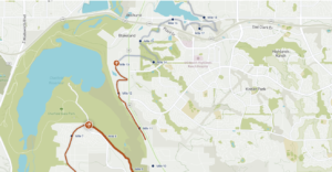
Though the High Line Canal is owned by Denver Water, the trail is managed in a public-private partnership across 11 jurisdictions and 13 regional agencies – including the Highlands Ranch Metro District. In fact about 7 miles of the High Line Canal is located in Highlands Ranch, from Mile 10 thru 17. The HR portion is primarily on the north west corner of HR, in and around the Fly n’ B Ranch and Wind Crest.
 The High Line Canal Conservancy (HLCC) was founded in 2014 to preserve, protect and enhance Colorado’s 71-mile canal, in partnership with the public. By 2017, HLCC had a Community Vision for this exceptional resource and In 2019 released a plan for the future of the High Line Canal. Notes Sarah Anderson, Water Quality Program Manager for the Denver Department of Transportation and Infrastructure of the High Line Canal plan, “This has a host of environmental, economic and social benefits, which includes not only reducing our flood risk and improving water quality, but also improves air quality and improves our resiliency to climate change.

Learn more about the High Line Canal, its history and legacy as well as trail maps, events and celebrations at https://highlinecanal.org/
View the Photos in better resolution HERE
Reference: Highlinecanal.org
Written by Marian Robinson 2024
Recent Comments